Southwest Florida is fifteen inches behind on rain. Tampa Bay is in extreme drought — one-day-a-week watering, extended through next March. Relief is coming from the last place you’d expect: the Pacific.
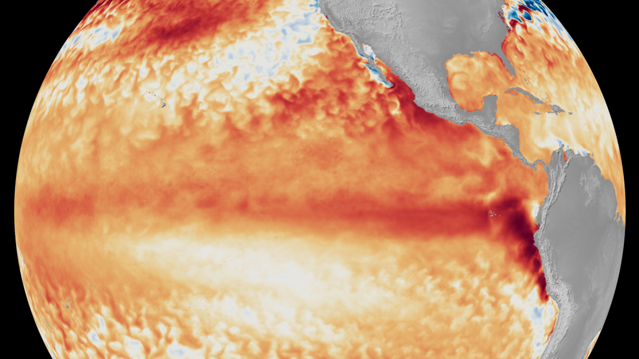
This El Niño is already flirting with records — a new daily heat record on September 19th, and 75 percent odds from NOAA it’s the strongest since 1950. I believe this one’s different: it’s being driven by a record rate of global warming, and the stable climate we built our lives on is gone.
The engine
Here’s the engine. Normally the trade winds pile warm water up near Indonesia. In an El Niño those winds weaken — sometimes reverse — and all that excess heat sloshes back to pile up along the West Coast, fueling fall and winter storms. Riding a Kelvin wave, it’s pushing sea levels up to a foot higher — San Francisco just saw its highest summer tide ever.
California isn’t waiting — a preemptive statewide state of emergency is already in effect.
The track record
The track record is stunning. Eight strong El Niños since 1957 — three true monsters: ’82-83, ’97-98, 2015-16. In all eight, our Gulf Coast ran wetter than normal every December through February: 151 percent of normal in ’82, 168 percent in ’97. The models agree — this winter runs wet.
The fine print
So the drought will very likely end. The fine print: a stronger jet stream means more frequent, stronger winter lows crossing the Gulf — and when their surge meets a high tide, low-lying areas flood. Drought relief and flood risk, same storms.
El Niño will probably end our drought — but the same winter storms could flood low-lying areas. Is that a trade worth making?
The Bunting Brief is Bob Bunting’s short-form series on the weather and climate forces shaping Florida’s Gulf Coast.
🎟️ Join us November 12 — From Climate Risk to Climate Resilience, Sarasota. Get tickets here.
📬 Get the Bunting Brief in your inbox — subscribe to the CAC newsletter.