
Here’s what that means for us

Spectacular sunsets are a side effect of Saharan dust – but so is a possible recurrence of red tide
(This article was originally published June 24, 2020 in Sarasota Magazine)
Strong winds across the ever-expanding Sahara Desert are creating a massive 2,000-mile dust cloud with two major pulses. As the earth warms, we are seeing more climate impacts that are both awesome in scope and a bit scary even to an atmospheric scientist.
What are the implications from this particular event? The most important and most agreed-upon result will be a tamping down of tropical storm activity while the cloud is over the tropical Atlantic. Dust is usually embedded in very dry desert air and hurricanes don’t like that. In addition, the dust acts as a reflector, keeping the sun from warming the top layers of the ocean.
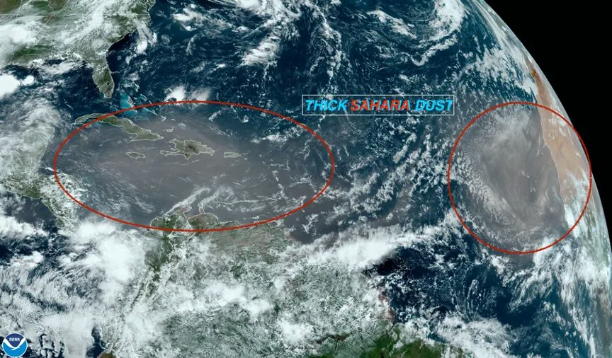
A thick cloud of Saharan dust is heading our way IMAGE: NOAA
Due to arrive in the Gulf of Mexico between Thursday and Saturday, we should see some spectacular sunrises and sunsets—and we don’t know how long it will take for the dust to pass. It depends on how soon the winds whipping though the Sahara die down. Sometimes the pulses continue for weeks, and sometimes they are just a transient event.
Another possible outcome, which is much less certain, is an enhancement of red tide in Florida in a month or so. The dust is loaded with iron, and as the cloud passes over the Gulf of Mexico some of it will sift down into the water. The Gulf of Mexico at this time of year is loaded with cyanobacteria. Some scientists believe that certain cyanobacteria in the presence of iron can convert nitrogen into a bio-available form loved by red tide. We shall see!
– Bob Bunting, CEO, Climate Adaptation Center