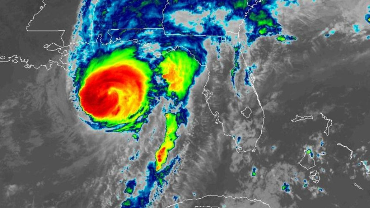
Today, Hurricane Isaias comes ashore on the northern Gulf Coast — and my thoughts are with everyone in its path.
Wednesday morning, Isaias was a tropical storm with 45-mile-an-hour winds. As of this morning, it’s a major Category 3 hurricane with 120-mile-an-hour winds, moving north-northeast at 16 mph — and its center is expected to reach the western Florida Panhandle coast this evening. Life-threatening storm surge and devastating winds are likely along the Panhandle and Alabama coasts.
Seven inches in Sarasota
Here in Sarasota, we’ve had seven inches of rain in the last few days — from the same environment that built this major hurricane. And this is happening in an El Niño year, in a climate-warmed world. The old rules about what a season should look like don’t apply anymore.
It just takes one hurricane hitting the U.S. coast to make it a devastating season. There’s nowhere to run and no way to hide these days. Our best strategy is to build resilience — so that when these storms do come, and they will, we’re as ready as we can be.
Building a coast that can take it
That’s the question we’ve been asking all season: how do we build a coast that can take this? On November 12th at Selby Auditorium, the CAC unveils the Living Laboratory for Coastal Resilience — ten miles of Sarasota Bay as a working prototype for every coastal community facing what’s coming.
Isaias went from a tropical storm to a major Category 3 hurricane in about two days. When a storm can move that fast, what does “being ready” look like to you?
The Bunting Brief is Bob Bunting’s short-form series on the weather and climate forces shaping Florida’s Gulf Coast.
🎟️ Join us November 12 — From Climate Risk to Climate Resilience, Sarasota. Get tickets here.
📬 Get the Bunting Brief in your inbox — hit the Subscribe button at the bottom of any page on this site.