Expect a tropical system to form in the Caribbean late this weekend or early next week
(Editor’s note: An earlier version of this article appeared in Sarasota Magazine)
Since my reports late last week the tropics have been on fire with four new named tropical storms and several more that look likely! I warned of a possibly historic Peak Hurricane Season. That appears more and more likely.
While two more of these potential systems are far offshore in the the Atlantic Ocean, one potential strom is more ominous for the Gulf Coast because it is forming in the South Caribbean Sea. It is a concern!
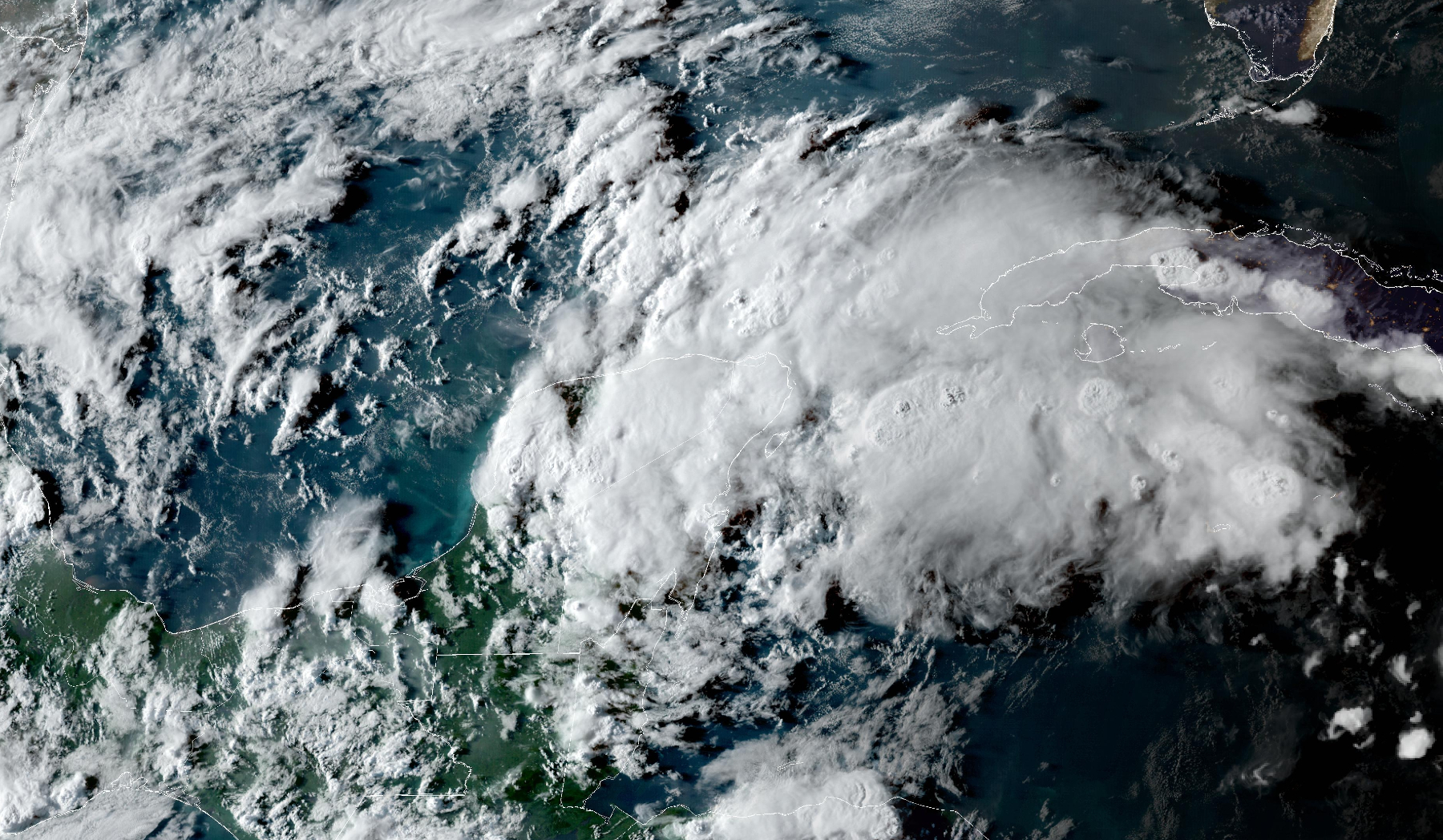
You can see it forming in the image below, acquired by NOAA’s GOES East satellite late Friday afternoon.
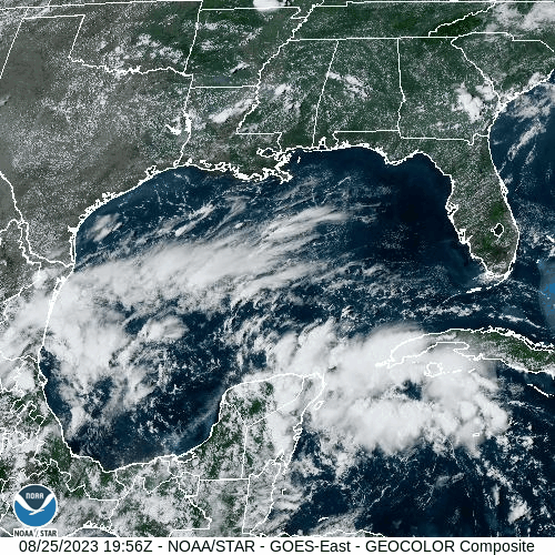
The cloud mass coming to a boil just south of Cuba is expected to form Tropical Storm Idalia late this weekend or early next week.
Please take some time to review these articles and many more about our rapidly warming climate and the major climate catastrophes that are rampant around the world this summer as 2023 is likely to set a new world temperature record!
The heat is causing Marine Heat Waves (MHW) as well as the land-based heatwaves that have plagued the US all summer. We’ve already discussed the 101.1°F SST recorded in the Florida Keys recently. Sea Surface Temperatures (SSTs) are near or above record levels in the Gulf of Mexico, which I have been talking about for months.
The image below shows SSTs in the Caribbean and Gulf of Mexico this morning and the potential path of the developing tropical storm (hurricane?). Please understand that IT IS TIME TO PAY ATTENTION!
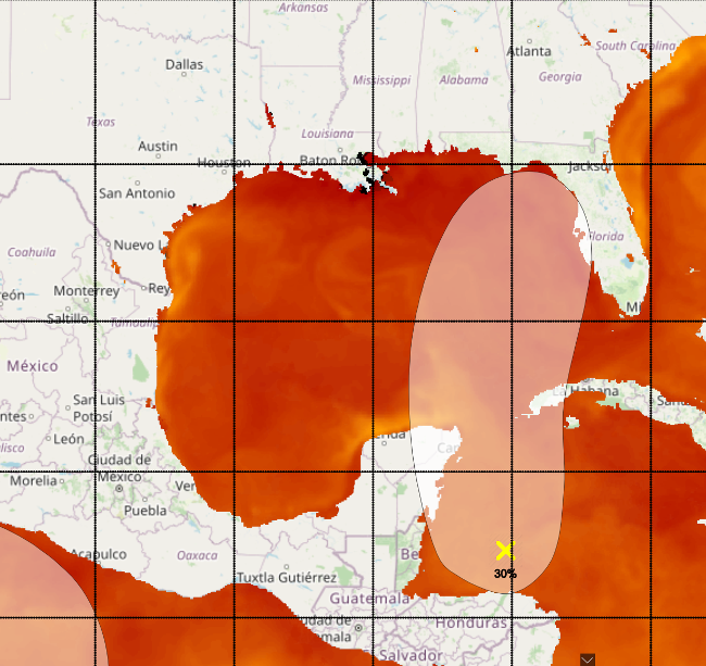
Image credit: NOAA
The red areas are SSTs above 86°F! This is HOT and hot SSTs are major fuel for hurricanes. Already nearing Cuba late Friday, the yellow X marks an earlier center of the forming system and the oblong light orange area is the potential path of the disturbance over the next 5 to 7 days.
While tropical system formation was only a 30% chance earlier, the National Hurricane Center has since revised its estimate to 40-60%. I believe it is almost a sure thing that a named storm develops as mentioned above. If it does reach tropical storm status, it will be named Idalia.
Since the Suncoast is in the potential path you should think about: What is your elevation? Where will you go if evacuations become necessary next week? Will you move your car to higher ground? Do you have your important papers packed so you take them with you? Are you prepared for long-lasting power outages?
Remember, the CAC had a nearly perfect long range and short range forecast for Hurricane Ian.
Make intelligent science based decisions. Protect your property, but most of all be sure to protect yourself!
The CAC is planning continued updates until this storm has passed. You may view these articles on the CAC website, at Sarasota Magazine, or if you sign up for our CAC monthly newsletter, you will automatically receive an email update in your mailbox as soon as it is posted. Click the “Subscribe” button at the end of this post.
Now Is a Good Time to:
- Consider if you are in a low-lying area and could face high tides and storm surge
- Figure out where you will go if you need to evacuate
- Stock up on water, batteries and essentials now while you have time
- Above all get prepared and watch what is going on in the tropics
And Remember…
- Sea levels are already nine inches higher than they were 50 years ago, so minor storms have bigger flooding impacts
- Escape routes can be very vulnerable because roads in many areas have not been raised
- Power can be off for days in some areas depending on the severity of winds and storm surge. Consider this in your planning
Help Us Spread The Word
If you find this content to be valuable, please forward this email to friends and colleagues and recommend they subscribe so they can be informed. Every bit helps and we thank you for your support.
Additionally, let us know what you like about this newsletter and what other content you’d like to see moving forward. Make sure to take a look at our Media Relations Page to see the impact the CAC is having with its global coverage. Our interviews, articles and conferences are reaching hundreds of thousands of people. And please consider sending us a donation or becoming a member of the organization. Your generosity is paramount to our success.
Not on our email list yet? You can subscribe by clicking the button below and filling out the contact form on the following page.