Title Image Source: CIRA/NOAA
And It’s Heading for Florida
Editor’s Note: This article by CAC CEO Bob Bunting was earlier released in the CAC Newsletter. You can sign up for the free newsletter here.
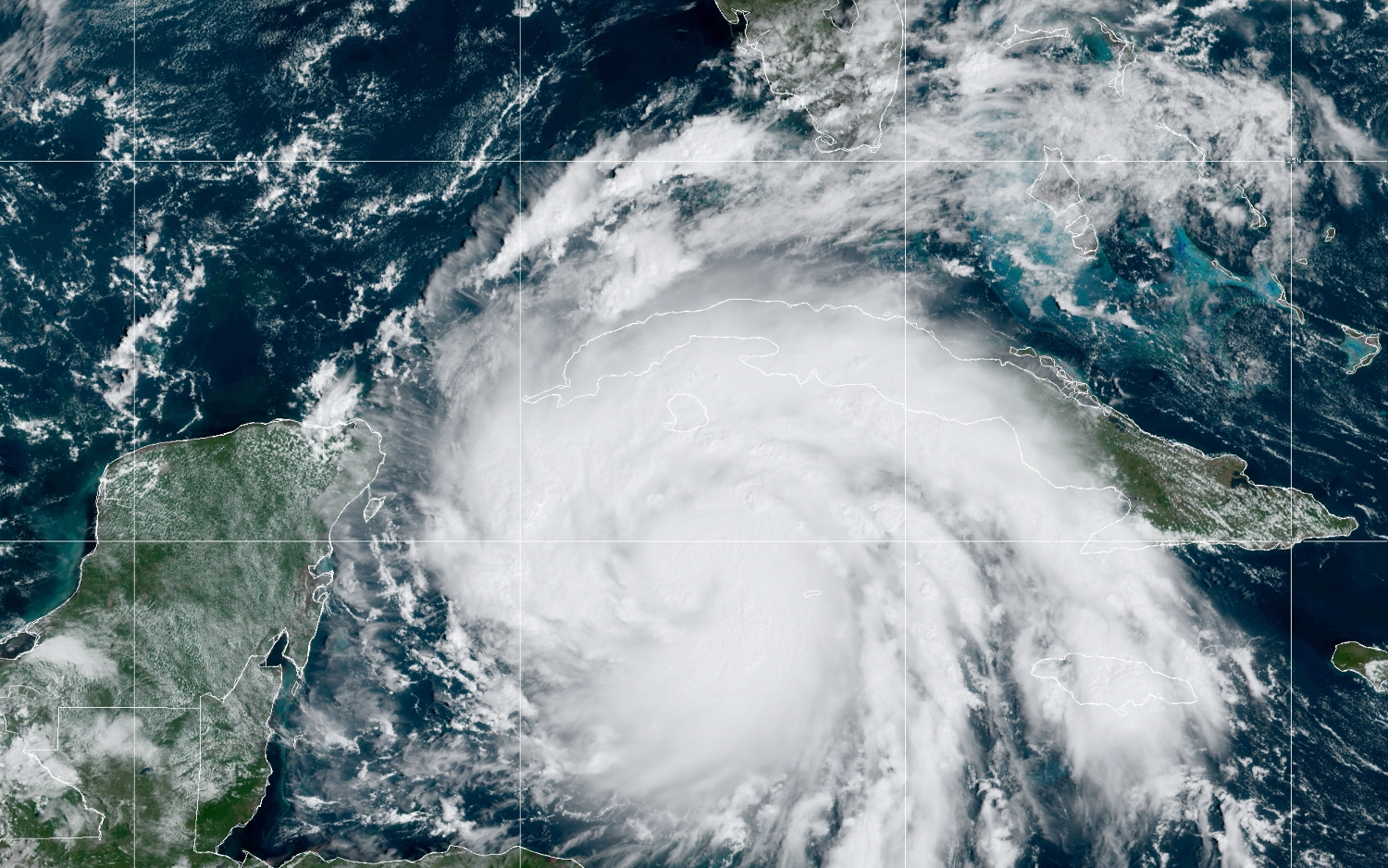
Ian is crossing almost directly over the Cayman Islands, and probabilities of a damaging hit to the Suncoast are increasing. The storm is now a Category 1 Hurricane and I expect explosive development as wind shear is low and sea surface temperatures are in the mid to high 80s!
A HURRICANE WATCH IS UP FOR ALL THE SUNCOAST INCLUDING TAMPA, BRADENTON, SARASOTA and VENICE.
For days I have been trying to communicate that this storm looked like one to remember. Now, the storm is getting organized and is taking a near perfect position to make landfall or parallel the coastline bringing the worst impacts of this storm on or very close to heavy population areas.
All precautions should be completed today and please read the advice on what you should do below. The main threat will be from Wednesday into Friday.
The path of the storm is now becoming clear but there is still some doubt about whether the eye will stay off the coast, be on the coast or move inland around our area. But it now looks like any of these scenarios will likely bring hurricane force winds to a portion of our area.
Here is the latest path projection.
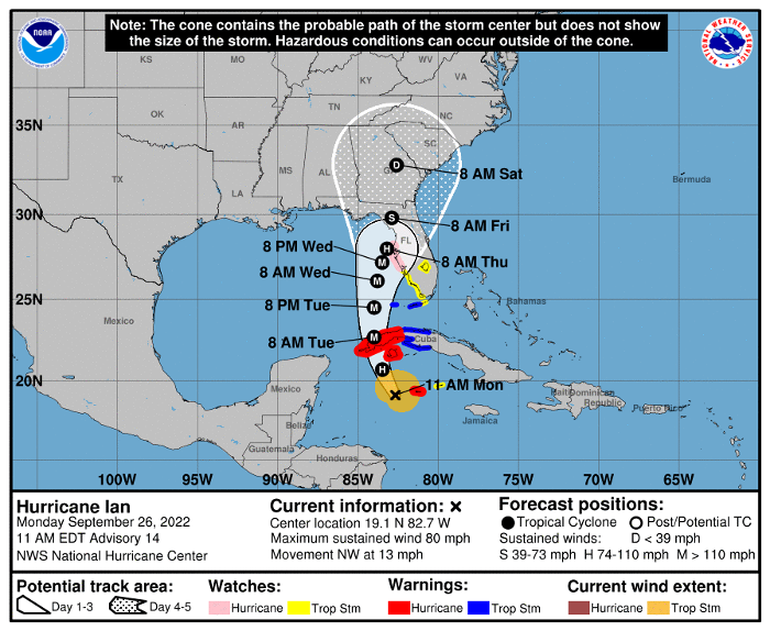
Image source: NOAA National Hurricane Center
The CAC has been warning that hurricanes will be more severe, closer to the coast of western Florida and slower moving than in the past due to the warming climate.
Ian is forecast to exhibit all these characteristics. First, the storm will most likely attain Category 4 status just south of our metro area [Sarasota – Ed.]. Second, the path is now becoming clear and it will be close or make landfall in our area. Third, the storm will slow down as it approaches so the period of heavy impact will be extended.
As the system moves northward north of Sarasota, wind shear will pick up and the system will begin losing strength.
Remember, this is a dynamic situation and the worst impacts are still several days away. That is why we all must be on top of this situation and be prepared for the worst and hope for a better evolution of the system than now looks likely.
I leave you with this dramatic satellite image from our super GOES-16 satellite. Compare it to the one I sent you yesterday.
Image Source: CIRA/NOAA GOES-East
Make intelligent, science based decisions. Protect your property but be sure to protect yourself!
The CAC is planning on continuing updates on the storm until it is gone. You may view these articles on the CAC website, Sarasota Magazine, or if you sign up for our CAC monthly newsletter using the “Subscribe” link below, you will automatically receive an email update in your mailbox as soon as it is posted.