Title Image Source: CIRA/NOAA
Hurricane and Storm Surge Warnings in Effect
Editor’s Note: This article by CAC CEO Bob Bunting was released earlier in the CAC Newsletter. You can sign up for the free newsletter here.
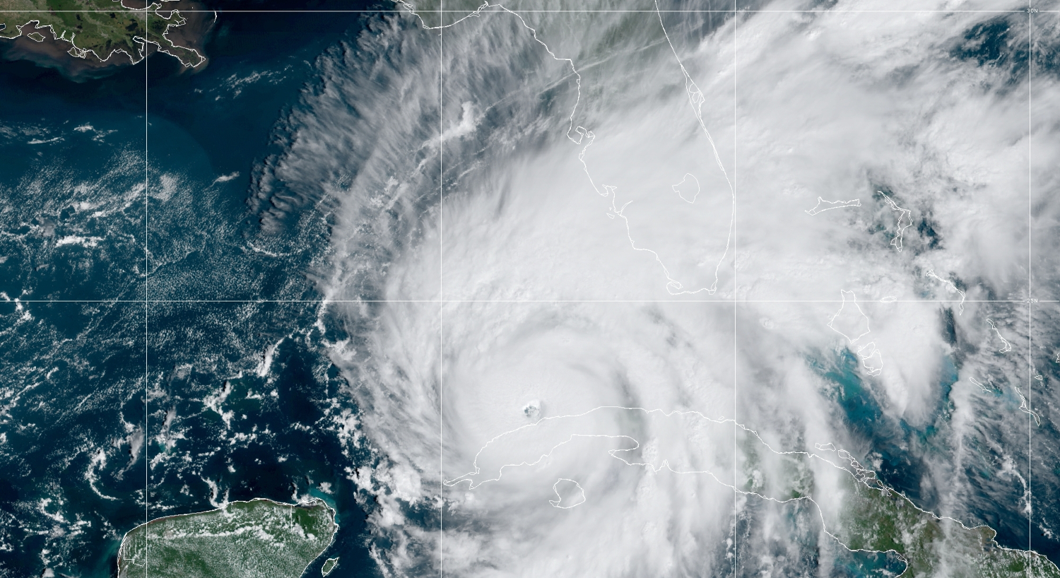
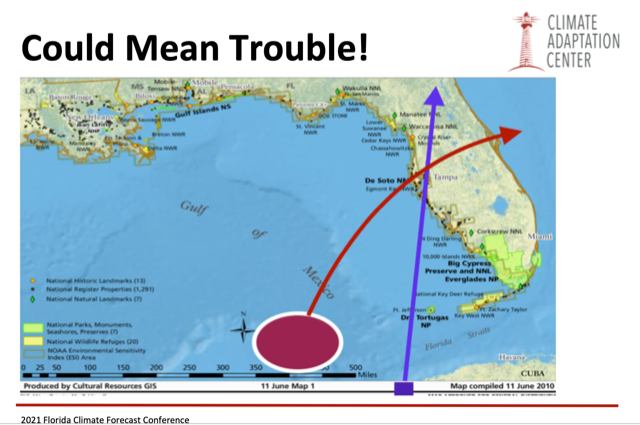
Ian is crossing western Cuba and is in the perfect strike position, the purple box, I outlined at the CAC Annual Climate Conference on November 9, 2021.
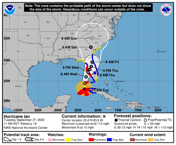
Probabilities are now high that this Category 3 Hurricane will make a landfall on the Suncoast. The critical times will begin Wednesday morning even before sunrise as gale force winds and heavy rains move into the area.
[Editor’s Note: the following GOES-East satellite image, showing Hurricane Ian entering the southeastern Gulf of Mexico, was taken after the newsletter was published.]
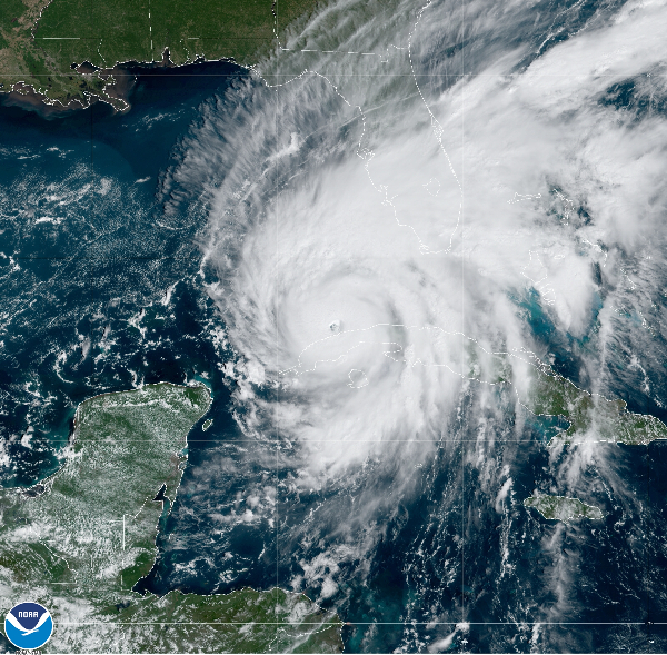
Hurricane Ian enters the Gulf of Mexico as a Major Hurricane. Image source: CIRA/NOAA GOES-East
Hurricane conditions will be probable Wednesday night into Thursday as the storm slows down its forward speed just before landfall.
High winds above hurricane force and storm surge to the south of the center will pass though much of the area. Peak Storm Surge is predicted be in the 5 ft to10 ft from the middle of Longboat Key northward to Tampa Bay and slightly less in the Sarasota Metro Area.
Peak winds at the center of the storm will be in excess of 100 mph at the time of landfall with high probability.
The storm may reach Category 4 status for a short time while approaching our coast but wind shear will eb increasing and should mean some slight weakening before landfall.
Very heavy flooding rains are also likely with 6 to 10 inches common and up to 20 inches in some places.
The slow movement will mean two days of tropical storm or higher conditions.
This is the time to listen very carefully to evacuation orders. Remember, the power grid will be damaged and electricity will go off and roads will quickly become dangerous to navigate.
Make intelligent science based decisions. Protect your property but be sure to protect yourself!
The CAC is planning on continuing updates on the storm until it is gone. You may view these articles on the CAC website, Sarasota Magazine, or if you sign up for our CAC monthly newsletter using the “Subscribe” link below, you will automatically receive an email update in your mailbox as soon as it is posted.