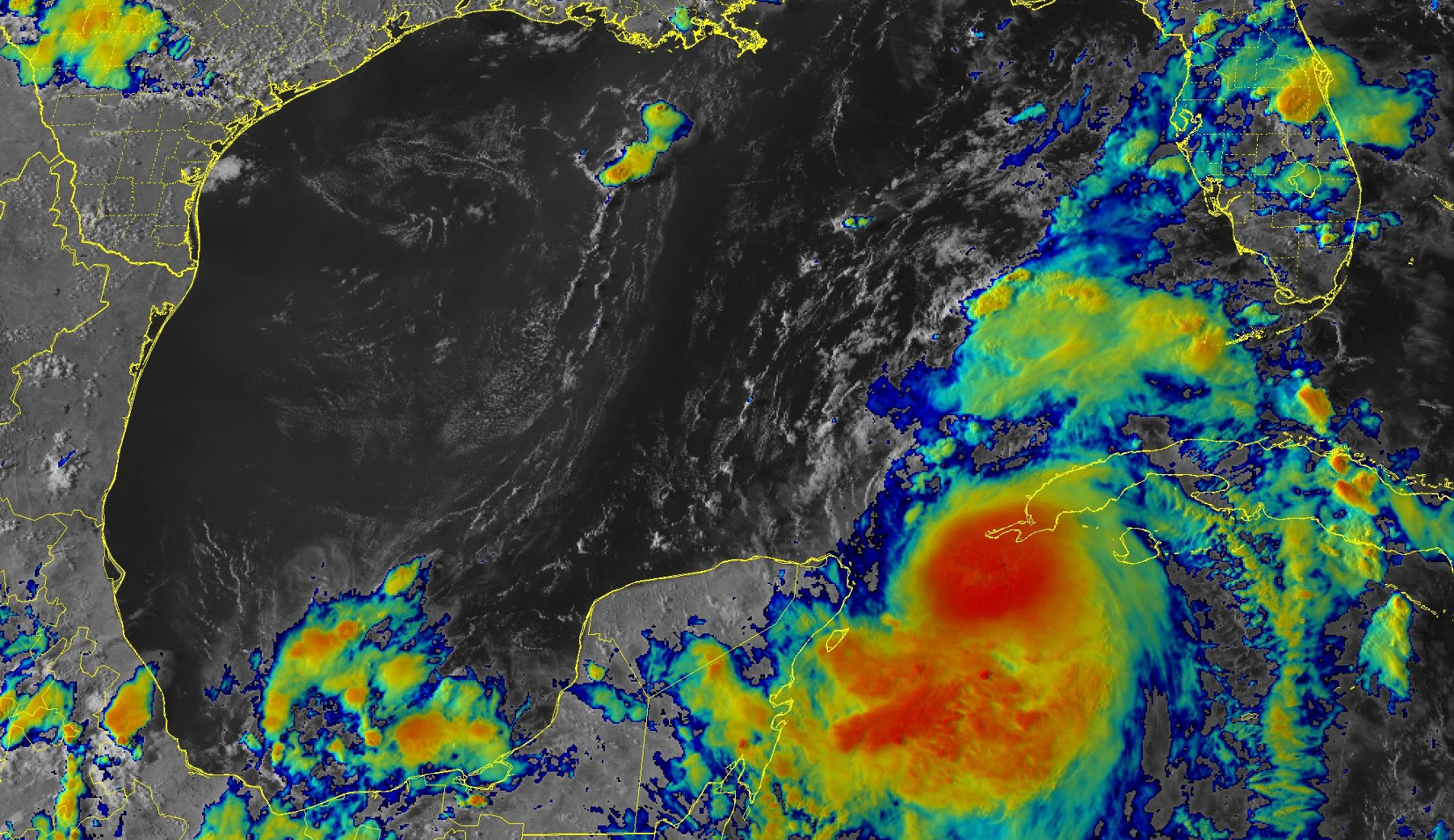
title image: Hurricane Idalia forming off western Cuba, August 28, 4:21 pm EDT.
NOAA/NESDIS/STAR GOES-16 infrared & geocolor
Idalia UPDATE – August 28th, Evening
Idalia Reaching Hurricane Status
Tropical Storm Idalia is about to become Hurricane Idalia as it starts its assault on the Florida west coast.
A Storm Surge Warning, Tropical Storm Warning, and Hurricane Watch are up for Sarasota
A Hurricane Warning is posted for coastal Manatee County
The path of Idalia is still somewhat variable. It is critical that you understand that a small shift of the eye of the storm to the east of its projected path could bring much more severe impacts to the mid-Florida Gulf coast, from Tampa Bay to Venice.
(Ed. note: an earlier edition mistakenly said “…west of its projected path..”)
What Are The Risks?
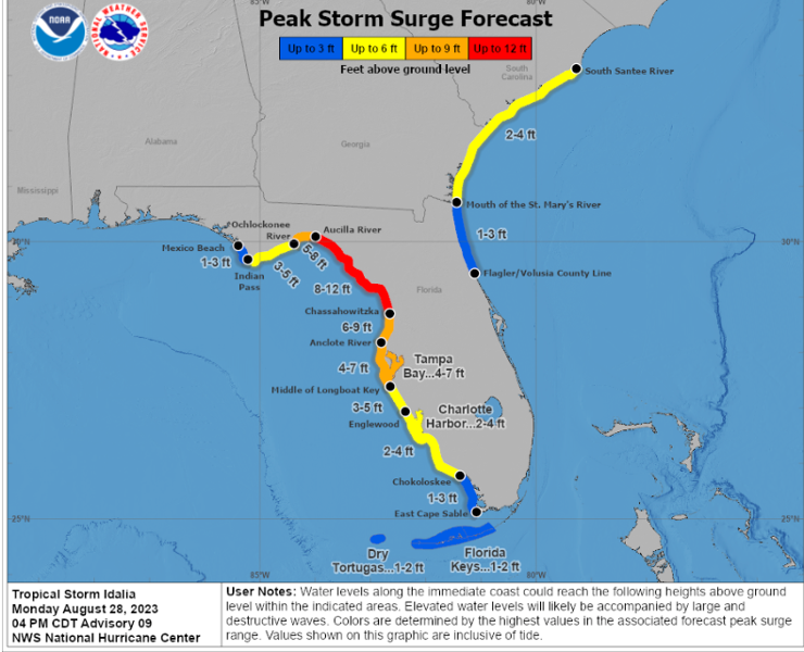
As it stands this evening, storm surge and high surf is likely to be the most critical expected impact, with 3 to 5 ft of peak surge in coastal Sarasota County, 4 to 7 ft in Manatee County and Tampa Bay and perhaps 8 -12 feet in the Big Bend, where Idalia could make landfall as a Major Hurricane Wednesday morning.
Please, as the Climate Adaptation Center has been driving home for months, KNOW YOUR ELEVATION.
If you live on a barrier island, LEAVE. If you are in an evacuation zone that has been asked to evacuate, LEAVE. Your escape routes may flood long before the storm hits its peak.
If you are in one of these places and you are at 5 feet above sea level, a 7 ft storm surge will be inside your house and your home could become unstable. Don’t do what dozens of folks did last year in Hurricane Ida. They are not with us anymore.
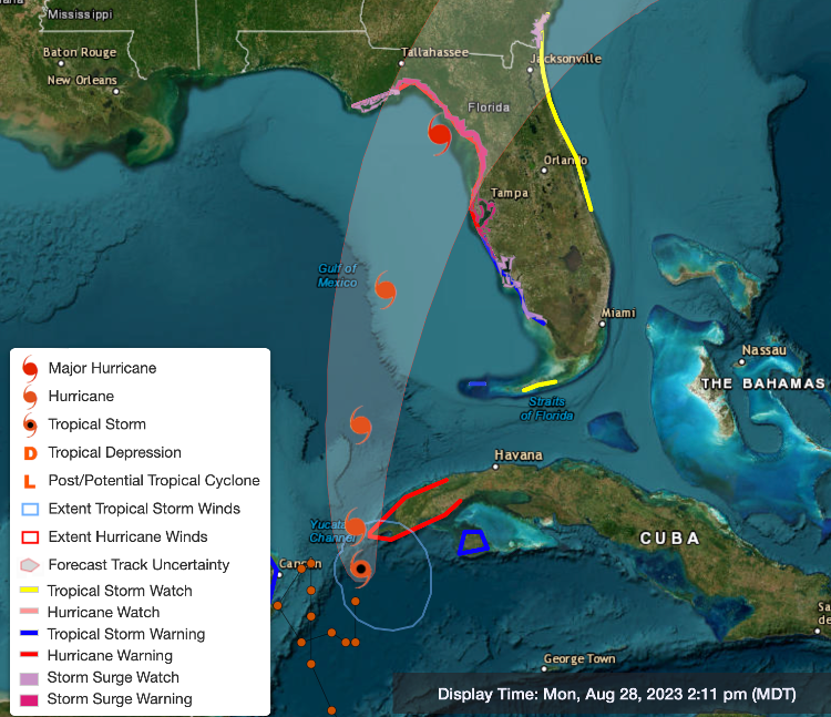
The current projected path of the storm is shown below, along with applicable warnings. Remember, the eye of the storm could be anywhere within the forecast cone. Storm impacts can and will be felt well outside the cone.
Potential Impacts
Because of the counterclockwise rotation of the storm, the strongest impacts will occur on its eastern side. As a result, the coastline and areas immediately inland are at higher risk than you might think. Storm surges will peak after the eye of the storm moves north of your location and winds shift to onshore, and gale force winds over the Gulf push storm surge to the maximum.
Winds in the Sarasota metro area will gust to over hurricane force in northern Manatee county.
Heavy rains from 2 to 4 inches are expected with heaviest amounts further north.
Expect gales to develop by late afternoon Tuesday and continue through the night and into Wednesday morning
Don’t forget—a Category 2 or 3 storm today will have much higher surges and tides than in years past because sea level is 9 inches higher than it was in 1950. That is a lot! The current Supermoon, 9 inches of sea level rise, and record high sea surface temperatures combine to make Idalia dangerous.
Climate Change? The climate has already changed!
What Should You Do?
Since the Suncoast is in the potential path, Please think about:
- What is your elevation?
- Where will you go if evacuations become necessary?
- Will you move your autos to higher ground?
- Do you have your important papers packed so you can take them with you?
- Are you prepared for long-lasting power outages?
Remember, the CAC long range and short range forecasts for Hurricane Ian were right on the money!
Make intelligent science-based decisions. Protect your property but be sure to protect yourself!