
To stay updated on hurricane development and climate news, subscribe to our newsletter in the link at the bottom of this page.
It’s not hurricane season for another 38 days, but the National Hurricane Center (NHC) is already watching a tropical disturbance in the eastern Atlantic.
Thankfully, it only has just a 10% chance of further development over the next week. In fact, it’s expected to move into unfavorable conditions shortly, so further development is not expected.
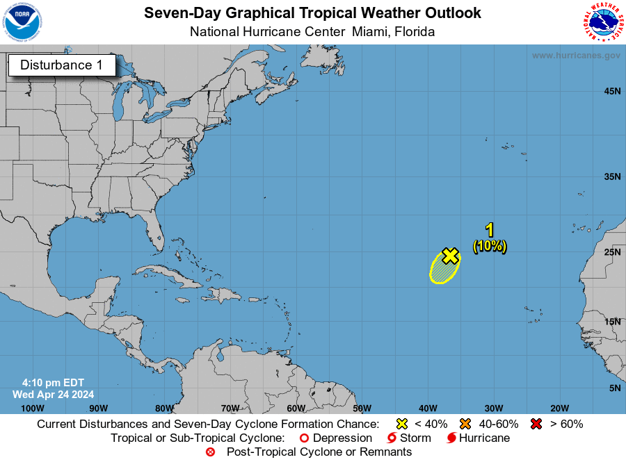 The system is 900 miles northwest of the Cape Verde Islands and is forecast to move southwestward at 10 mph to 15 mph.
It will move into an area of stronger upper-level winds on Wednesday night and Thursday, which will likely inhibit the system from strengthening.
The NHC had to send out a Special Tropical Weather Outlook for this disturbance. That’s the regular Tropical Weather Outlooks don’t start until May 15.
While this disturbance will likely fizzle out soon, it’s a great reminder that Hurricane Season is right around the corner, starting officially on June 1.
If it were to develop and become a named storm, it would be Tropical Storm Alberto.
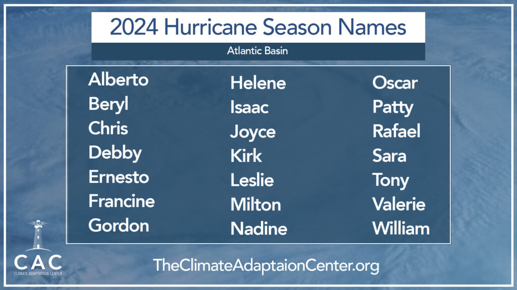
The 2024 Atlantic Basin hurricane names.
This looks like a very busy hurricane season this year. You can see the Climate Adaptation Center’s 2024 Hurricane Season Forecast here.