
To stay updated on important climate news, subscribe to our newsletter in the link at the bottom of this page.
A yellow-orange haze smothered southern Greece, including Athens, Tuesday after days of strong winds from the south blew in massive amounts of dust from the Saharan Desert in Africa.
The dust limited visibility and prompted warnings from the authorities of breathing risks. Dust concentrations can reduce sunlight and visibility while increasing concentrations of fine pollution particles, posing risks for people with underlying health problems.
Greek officials say it is one of the worst such episodes to hit the country since 2018.

April 23, 2024. People in Athens sitting outside in the haze. Photograph: George Vitsaras/EPA
Greece had already been struck by Sahara dust clouds in late March and early April which also smothered parts of Switzerland and southern France. The Greek weather service said the skies would begin to clear on Wednesday.
The Sahara Desert releases 60 to 200 million tons of mineral dust per year. While the largest particles come rapidly back down to earth, the smallest can travel thousands of miles.
While it’s not typically as pronounced as what’s happening in Greece, Saharan dust periodically travels to Florida throughout the year. Thunder and wind storms cause conditions that pick up dust and blow it great distances, and sometimes westward toward the United States.
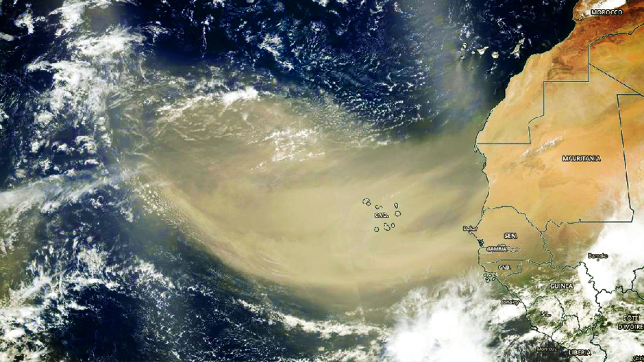
In this 2020 NASA satellite capture, a large swath of Saharan dust stretches off the African coast into the North Atlantic Ocean. Photo: NASA Worldview
When significant amounts of Saharan dust arrives in Florida, we get more vibrant sunsets and sunrises as a result of the dust. The whole sky changes. The dust acts like a huge diffuser and gives a soft, warm glow to the landscape. Also, just like in Greece, those with respiratory ailments face the increased risk of flare-ups.
Impacts on hurricanes
A Saharan dust storm tends to suppress hurricane development. In fact, meteorology has a term for this weather ingredient called the Saharan Air Layer (SAL).
The air is super-dry air. Has a very strong surge of air embedded within it, called the mid-level easterly jet, that can rip a storm apart that’s trying to develop with wind shear. It’s also believed that the dust suppresses cloud formation. So this Saharan dust layer can have a blanketing effect on tropical development.
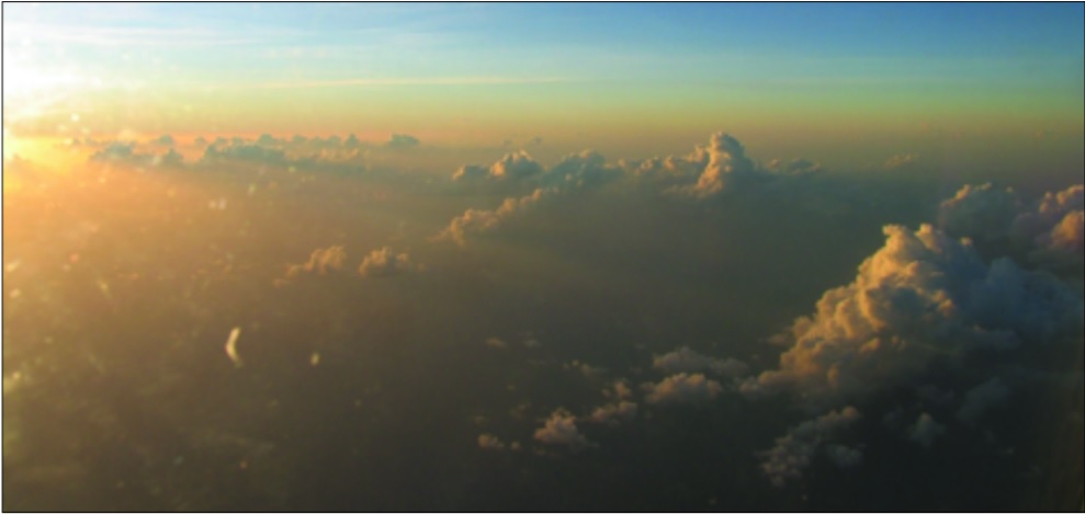
In this 2006 photo, Saharan dust gives the sky an orange glow during a late afternoon sunset in the eastern Caribbean. A NASA DC-8 aircraft flown out of Cape Verde, Africa, started tracking this dust on September 13, 2006; on September 18, a NOAA P-3 Orion aircraft picked up its trail and captured this photo. (Courtesy Jason Dunion)
As the Climate Adaptation Center tracks hurricane season this year, this dust is something you’ll hear talk about from time-to-time because of its influence on developing storms.
How climate warming is impacting these dust storms
Climate change can influence Saharan dust storms. Warming temperatures can impact wind patterns and increase desertification, both of which can contribute to more frequent and intense dust storms. Additionally, changes in rainfall patterns due to climate change could affect the amount of dust available for storms.
The CAC is committed to the climate conversation. We do this with events like the Climate Champions Awards Ceremony, Hurricane Season Forecast Day and the upcoming Annual Climate Conference in November, that will focus on human health. We also give climate presentations to thousands of people throughout the year. You can support us in helping our conversation going by making a donation or becoming a member.