Drought, La Niña and Climate Warming Combine for a Hot July 4th
There’s an ongoing weather and climate event in North America that’s looking like a slow-motion train wreck: the drought in the western third of the US, covering portions of the High Plains and much of the Southwest. The slow-motion part of this story is that the drought has been getting worse for 20 years.
A map from the U.S. Drought Monitor shows that large portions of North and South Dakota, western Colorado, and even a swath of Wyoming are in severe, extreme or exceptional drought.
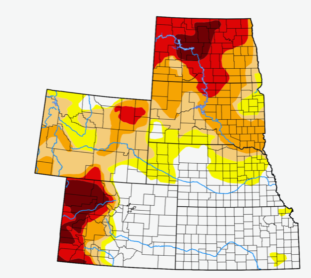
2021 drought map for the High Plains states. Credit: US Drought Monitor
A second map shows that the West and Southwest have even larger areas of extreme to exceptional drought.
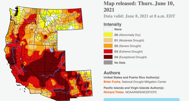
Drought map – western US Credit: US Drought Monitor
Some places have experienced conditions so dry that no measurable rain has fallen for a year or longer! In 2020, Las Vegas went 240 consecutive days without rain — a record.
The West is particularly dependent on snowfall in the mountains to fill reservoirs. Snowfall in general is also decreasing in the West. Last winter, from the Colorado Rockies to the California Sierras, snowpacks were well below normal.
Water is the lifeblood of society, but it’s getting scarce. The societal impacts will be increasingly profound in the years ahead. California, Arizona, and Nevada alone total more than 50 million residents.
Fires have been rampaging through populated areas in recent years across much of this region, and another hot fire season is already upon us. Hot is also the right word for temperatures this summer. Right now – and at this writing it is early in the summer – records are being set as the first heat wave of the season is underway. Extreme air temperatures are fueled in part by unusually rapid heating of the dessicated landscape — itself a result of years of drought.
The absence of rain and snow has been exacerbated by a persistent La Niña pattern in the Pacific Ocean. La Niña creates colder water in the Pacific, and the colder water forces the jet stream that controls storm patterns to the north.
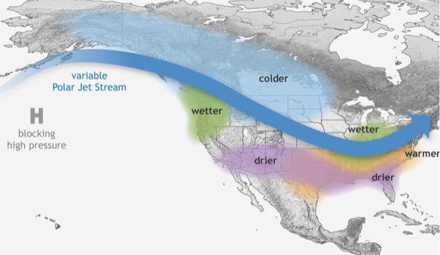
La Nina winter jet stream over North America Credit: NOAA
As you can see from the map above, a swath extending from the Southwest through the southern states experiences drier conditions during La Niña winters. So, with a long-term drought and La Niña, we have a one-two punch in progress.
The first punch is clearly created by a warming climate. Since 1990, there has been acceleration in global warming, and Earth’s temperatures have set new high records in 17 of the years since the turn of the millennium. We estimate that the drought in the Southwest has reached this severity only one other time in the past thousand years. Of course, fewer people were impacted back then, but millions more are affected today!
The La Niña in progress is expected to continue at least to year-end. The graph below shows the model outputs that forecast La Niña. The average of the forecasts is represented by the solid blue line.
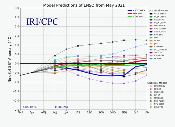
ENSO forecast as of May 2021 Credit: International Research Institute
La Niña also diminishes wind shear, the increase in wind speed as one moves from the surface of the earth to higher levels in the atmosphere. When that happens, hurricanes in the Atlantic, the Gulf of Mexico, and the Caribbean tend to be stronger, since they are not disrupted by wind shear. The lack of wind shear is one reason the CAC is forecasting 20 storms this year, with 10 hurricanes and 3–5 major hurricanes.
The drought caused by La Niña has created the driest May on record in parts of Florida. Drought in May correlates well with major hurricanes in South Florida later in the season. In fact, from 1925 to 1993 there were 8 major hurricanes that impacted South Florida, and 7 of them came after dry Mays. Will this be another such year?
I leave you with this recent photo of the Lake Mead reservoir and the Hoover Dam, on the outskirts of Las Vegas. Today, Lake Mead is at its lowest level since the dam was built in the 1930s!
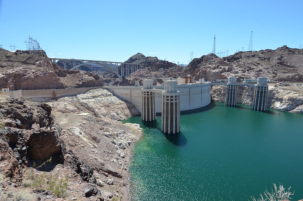
Image Credit: Steven Lek/license: CC BY 4.0