Antarctic and Arctic – truly “polar opposites”
Part 2: The Antarctic
The Antarctic — ranging from latitude 60º South to the South Pole — encompasses the ice-covered continent of Antarctica and the surrounding Southern Ocean. The frigid heat sink of the Antarctic, like the Arctic, plays a crucial role in moderating global climate. The energy transfer between the hotter lower latitudes and the Antarctic drives atmospheric and oceanic circulation throughout the Southern Hemisphere.
Even more than the Arctic, the Antarctic has historically been “out of sight, out of mind.” Uninhabited, except for a few hardy scientists, it is seldom in the news unless it sets a new record low temperature. (In case you’re wondering, -128.6ºF or -89.2ºC.) Nonetheless, we’ll see that the effects of global warming on the Antarctic will reverberate across the globe for centuries to come.
But first, a little background.
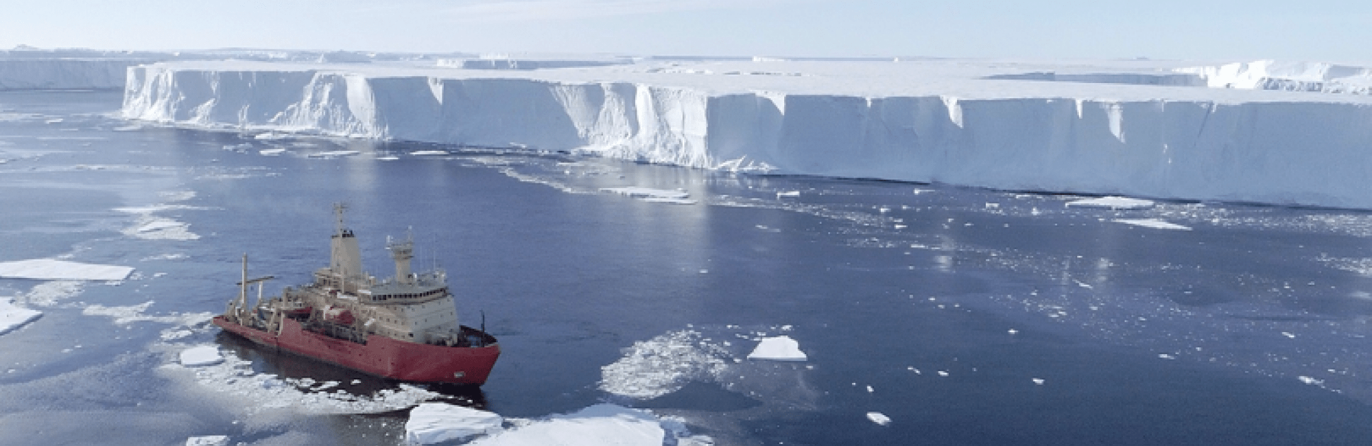
Antarctica is the world’s fifth largest continent, covering roughly 20% of the southern hemisphere. Remote, inhospitable and with no indigenous population, Antarctica was originally believed to be just a group of islands — not recognized as a continent until 1840. Antarctica is unique in many ways — of all the continents, it is the highest, coldest, driest, windiest and iciest. It spans 5.5 million square miles, with a thick ice sheet covering about 98% of the land mass. The continent is divided into East Antarctica, largely composed of a high ice-covered plateau, and West Antarctica, which is essentially an ice sheet covering an archipelago of mountainous islands.
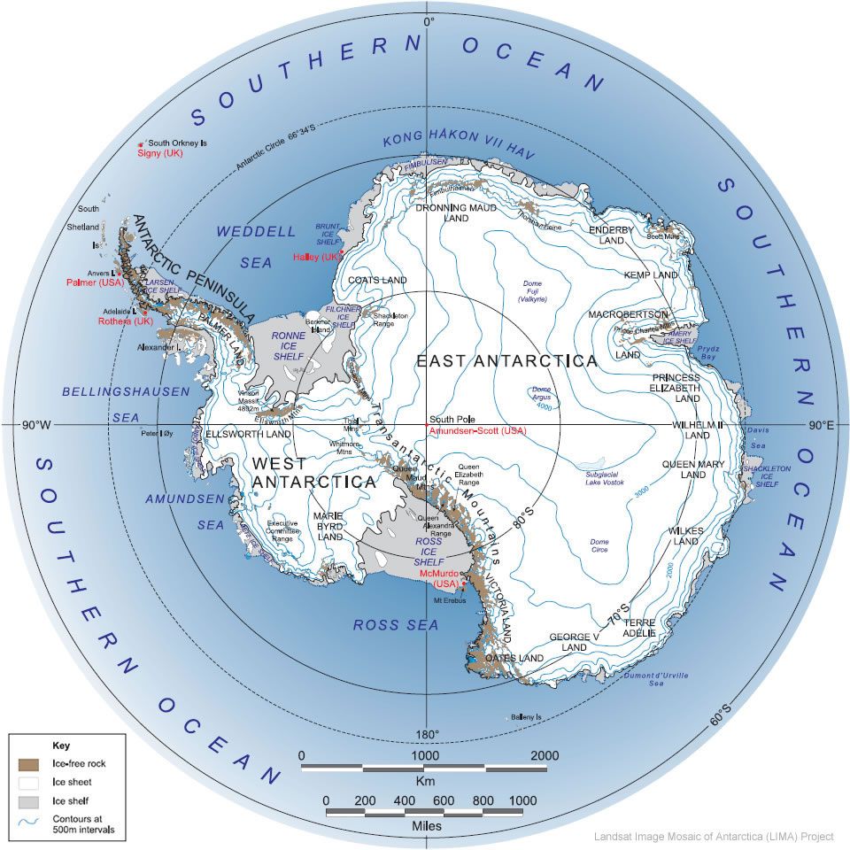
Map courtesy of the U.S. Geological Survey and the International Landsat Image Mosaic of Antarctica (LIMA) project
The continental ice sheet contains approximately 7 million cubic miles of ice (about 29 million cubic km), representing about 90 percent of the world’s ice and 80 percent of its fresh water. Its average thickness is about 5,900 feet (1,800 meters) — its maximum thickness is an astounding 15,670 feet (4,776 meters). The highest point on the ice sheet is 13,451 ft. above sea level. Ice shelves, extensions of the ice sheet floating on the sea along the shoreline, can be found along 75% of Antarctica’s coast.
Ice sheets in both hemispheres are constantly losing ice, through melting at the surface and through outflow to the ocean where ice melts into the ocean or breaks off to form icebergs (which later melt into the ocean.) Ice sheets are continually replenished by accumulated snowfall.
Global Climate Warming and the Antarctic
As we pointed out in Part 1 of this article, there are fundamental differences between the Arctic and Antarctic and their response to global climate warming.
The Arctic is an ocean ringed by islands and the northern fringes of North America and Eurasia. Retreating sea ice in the Arctic Ocean is having a positive feedback effect, contributing to rapid warming of the ocean and its surrounding land masses. In turn, the quickly warming Arctic is affecting atmospheric and oceanic circulation throughout the northern hemisphere.
The Antarctic consists of the ice-covered continent of Antarctica, surrounded by the Southern Ocean. While the Arctic Ocean moderates the climate throughout the Arctic, there is no such moderating influence on the South Pole climate. Instead, the high elevation and permanent reflective snow cover of the Antarctic ice sheet intensifies the naturally cold climate. In the Antarctic winter, sea ice forms along the coast, effectively moving the heat source of a relatively warm ocean far away from the ice and snow of the interior.
Nonetheless, climate warming is leaving its mark in Antarctica. The west coast of the Antarctic Peninsula is the most rapidly warming areas in the Southern Hemisphere. Between 1950 and 2000 the Antarctic Peninsula warmed about 3ºC, at a rate five times the global average. The Southern Ocean is also warming, with the Antarctic Circumpolar Current warming more rapidly than the global ocean average. The figure below shows the rate of warming across Antarctica from 1957 – 2006. Although the Antarctic Peninsula and the West Antarctic Ice Sheet are warming much faster than the rest of the continent, even the East Antarctic Ice Sheet is warming.
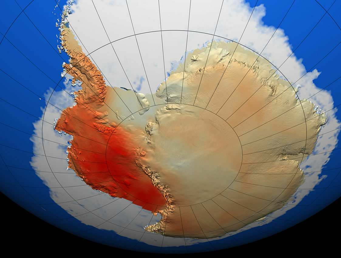
Surface temperature warming, ranging from 0.12C per decade in East Antarctica, to more than 0.3C per decade in West Antarctica. Credit: NASA
Ice Sheets and Sea Level Rise
Much of the sea level rise to date has been the result of thermal expansion of the warming oceans and melting of individual glaciers in the lower latitudes. However, as climate warming accelerates and destabilizes the polar regions, ice sheets are playing a growing role in sea level rise.
Climate warming is shrinking polar ice sheets in both hemispheres — on Greenland in the north and Antarctica in the south. And the rate of loss is accelerating. Shrinking ice sheets lead to sea level rise. The Greenland ice sheet contains enough ice to raise global sea level by 23 ft (7 m.) There is enough water locked up in the Antarctic ice sheet to raise global sea level by a mind-boggling 200 ft (60 m.)
That sort of transformation would take centuries, but the changes that can happen in just decades are increasingly worrying.
An international team, supported by NASA and the European Space Agency, used satellite data to determine that the Greenland and Antarctic ice sheets together lost an average of 81 billion tons per year in the 1990s. By the 2010’s the rate skyrocketed to 475 billion tons per year — a sixfold increase! By 2020, the two ice sheets had lost 6.4 trillion tons of ice since the 1990s.
The ice lost by the two ice sheets is responsible for 1/3 of all sea level rise. Interestingly, the smaller Greenland ice sheet is responsible for 60% of the ice lost, while the massive Antarctica ice sheet only accounts for the remaining 40%.
The disparity is explained by the different response of the two regions to global climate warming. While both ice sheets are losing ice by outlet glacier ice melting when it reaches the ocean, in the fast-warming Arctic this is compounded by warm air melting the surface of the Greenland ice sheet. This surface melt currenlty accounts for half of the total ice being lost by the Greenland ice sheet.
In contrast, despite the rapid rate of warming in West Antarctica, climate warming of the colder Antarctic has yet to lead to large scale surface melting of the ice sheet. Ice loss in Antarctica is mostly the result of outlet glaciers flowing to the sea, where the ice melts in the ocean. The impact of climate warming on ice loss in the Antarctic is driven by rising temperatures in the Pacific Ocean, which has changed atmospheric circulation around the continent, which in turn is affecting ocean currents. Deep ocean water, “warm” by Antarctic standards, is now upwelling along the coast, melting previously stable ice shelves from below, leading to knock on effects on outlet glaciers and ultimately the ice sheet itself.
Ice Shelves – the Weakest Link
When ice flowing outward from the ice sheet reaches the sea, if temperatures are cold enough the ice doesn’t melt right away. Instead, it floats on the surface, growing in size as outlet glaciers behind it continue to flow into the sea. The resulting ice shelves can survive for thousands of years, as icebergs lost from their margins are replaced by ice flowing in from their attached ice sheet outlet glaciers.
Ice shelves play a key role in controlling the loss of ice from the ice sheet to the ocean. As they grow, ice shelves eventually run into obstacles such as islands or peninsulas, or run aground against underwater barriers. As an ice shelf is held up by obstructions, it holds up the tributary glaciers that feed it. The glaciers then thicken and slow down, contributing less to sea level rise.
Ice shelves are very sensitive to change in their environment. Warm winds can increase surface melt in the Antarctic summer, and the melt water can widen cracks in the ice when it freezes and expands in the winter. Over time, this fracturing process can weaken the ice shelf from above. At the same time, upwelling warm ocean water melts the ice shelf from below, both thinning the ice shelf and weakening its bond to the underwater obstacles that help the ice shelf to hold back the flow of glacier ice. Ultimately, thinning and weakening of the ice shelf can lead to its sudden collapse and breakup.
In the words of Dr. Ella Gilbert, a research scientist in the University of Reading’s Department of Meteorology: “Ice shelves are important buffers preventing glaciers on land from flowing freely into the ocean and contributing to sea level rise. When they collapse, it’s like a giant cork being removed from a bottle, allowing unimaginable amounts of water from glaciers to pour into the sea.”
West Antarctica is Ground Zero for Sea Level Rise
Most of the ice shelves at risk are on the rapidly warming Antarctic peninsula in West Antarctica , exposed to warm westerly winds and upwelling warm water. The poster child for ice shelf collapse is the “Larsen B” ice shelf on the Antarctic peninsula. Estimated to be over 10,000 years old, Larsen B held back outflow from three glaciers. In 2002, over just 35 days, 1,255 square miles of the weakened shelf suddenly disintegrated into a melange of ice floes, slush and icebergs.
Satellite image of the aftermath of the 2002 Larsen B collapse. Credit: Wikimedia CC BY 3.0
After the 2002 collapse, the glaciers behind the collapsed part of the Larsen shelf accelerated their rate of ice flow as much as eightfold — equivalent to a car accelerating from 55 to 440 mph. Dr. Gilbert’s cork was out of the bottle!
The collapse of West Antarctic ice shelves may have more dire consequences in the future, including…
The Doomsday Glacier
The West Antarctic Ice Sheet (WAIS) is classified as a “marine” ice sheet, meaning its base is below sea level. It is the largest marine ice sheet in the world, holding enough ice to raise global sea level 3.3 m (10.8 ft) should it melt.
Marine ice sheets like WAIS have an inherent instability because their contact with the bedrock or sea floor is always below sea level — leaving the “grounding line” continuously exposed to melting by warm seawater.
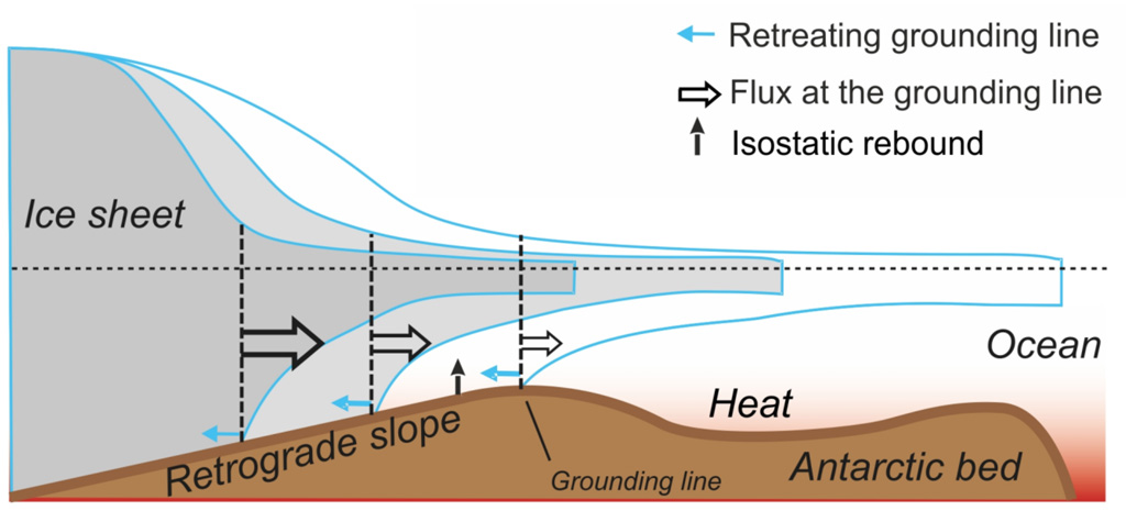
Illustration of Marine Ice Sheet Instability. Thinning of the buttressing ice shelf leads to acceleration of the ice sheet flow and thinning of the marine-terminated ice margin. Because bedrock under the ice sheet is sloping towards ice sheet interior, thinning of the ice causes retreat of the grounding line followed by an increase of the seaward ice flux, further thinning of the ice margin, and further retreat of the grounding line. Credit: IPCC SROCC (2019) Fig CB8.1a, via Carbon Brief.
The figure above shows how this situation could evolve in West Antarctica, where the ice sheet is grounded in a large basin. Once the ice sheet grounding line retreats onto a reverse, or retrograde, slope it reaches a tipping point, where further retreat leads to faster ice flow and a further retreat of the grounding line in a positive feedback loop.
The WAIS is currently thought to be stable because of the buffer provided by ice shelves and local regions where the shape of the ground beneath the ice acts to oppose the overall trend.
The climate warming threshold at which the WAIS will enter this irreversible ice loss process is thought to be between 1.5ºC and 2ºC of global average warming — a point we are almost certain to reach this century. Staying below this threshold is key to preserving the West Antarctic ice shelves and their ability to hold back their tributary glaciers.
But for some West Antarctic glaciers, it may already be too late.
The Thwaites Glacier, AKA The Doomsday Glacier, flows into the Amundsen Sea and extends well into the interior of the WAIS, where the bed of the ice sheet lies 2,000 m (6,500 ft) below sea level. In addition to the “Doomsday” moniker, Thwaites has been called the most important glacier in the world.
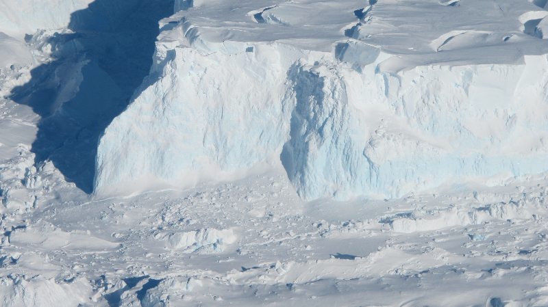
Thwaites Glacier Image: NASA
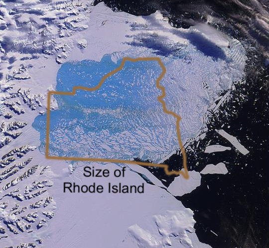
At 74,000 square miles, it is roughly the size of Florida and it is the widest glacier in the world at about 80 miles (120 km). It is solely responsible for about 4% of the annual global sea level rise. If it were to collapse, global sea levels would rise by 2-3 feet. And it’s in trouble.
The vulnerable glacier was a featured subject at the same December 2021 American Geophysical Union conference we discussed in Part 1 of this post. In a press release, Ted Scambos, a senior research scientist at the Cooperative Institute for Research in Environmental Sciences (CIRES) and the U.S. lead for the International Thwaites Glacier Collaboration (ITGC), pointed out that Thwaites has doubled the speed of ice outflow in the last 30 years. The ice would flow to the sea even more rapidly, if it wasn’t for an ice shelf holding back the eastern third of the glacier.
Unfortunately, the critical ice shelf is failing under continued erosion from below by warm ocean water. The ice shelf already exhibits large fractures, and scientists predict it will collapse within a few years. After the ice shelf collapses, the glacier will accelerate. At the same time, warm ocean water will attack the glacier at the grounding line — the point where the outflowing glacier begins to float — leading to further retreat, as shown in the diagram above.
Are We Doomed?
Not right now. The key takeaway is that if we follow our current trajectory and exceed 2ºC of warming, we will likely initiate irreversible, large scale ice loss from Antarctica. The resulting inexorable sea level rise, will continue whether or not we reduce future emissions. If we only look out as far as 2100, sea level rise will likely be 1-2 feet, but sea level will continue to rise, year after year, for centuries to come.